A "Not So" Short Story
1892 Deed -- Simmons to Jake Mackey deed was recorded on 12/6/1892. Also, Issac Baley purchased the adjacent parcel on the same day. Both Mackey & Bailey may have lived on the land for years prior to purchasing.
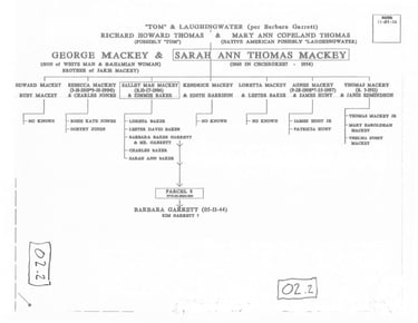
Family Tree of Jake & Sarah Mackey, Isaac & Ella Mackey Baley, and George & Sarah Mackey -- from "The Marriage List" & "Person Report of Richard Howard Thomas & Mary Ann Copeland provided by A. Towler, B. Garrett & E. Dorsey.”
1906 Soils Map -- shows Mackey Road extending west from Probart Street leading up to the community of “Pinnacle" at the time comprised of a cluster of (5 or so) structures located between Camp Transylvania & Hunts Branch.
1945 USGS Quad Map (Rosman) -- shows Mackey Ridge Road & trail extending through "Pinnacle" & west well up into the mountains showing at least (9) structures on both sides of the road between Transylvania School Camp & Hunts Branch.
Emma Dorseys's Map of "Pinnacle" -- This "Map" was hand drawn by Emma's granddaughter in 2024 from Emma's memory. Emma was born in Brevard and lived in “Pinnacle” from the early 1940's until 1954. Emma's "Map" shows (8) houses & a Slaughterhouse, various drives, paths & the Main Road (aka Mackey Ridge Road) (now Pinnacle Road).
1964 William Leonard Survey (partial) -- clearly showing Mackey Ridge Road & at least (5) remaining structures in 1964.
2003 Jenkins Survey -- This landmark survey is the first depiction of Jake & Isaac's land with sub-parcels all on one map. Parcel 1-5 were passed on to the Robinsons, the Smiths, Flora Bailey Aiken, Edna Mae Williams, McCone Camp and Parcel 6 to the Heirs of Jake & Isaac. Also, the BMC, Garrett & Payne parcels are indicated on the north side of the Road.
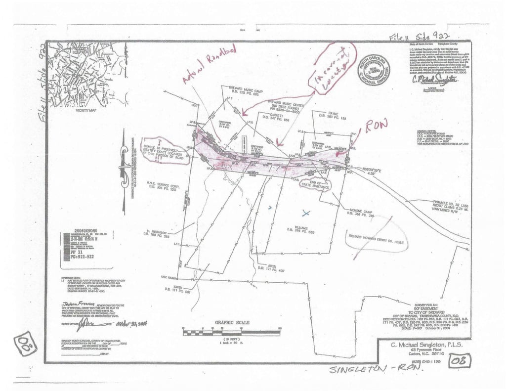
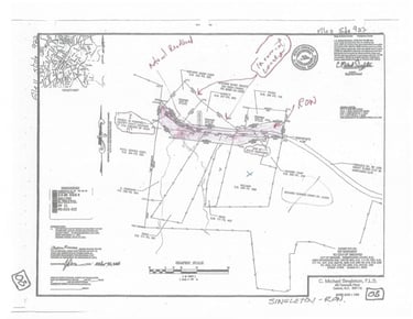
2006 Singleton Survey, (prepared for the City of Brevard) (File 11 Slide 922) -- Is titled "50' Easement for the City of Brevard" & contains incorrect information as follows.
The note "unable to positively locate end of the road” is not supported by subsequent surveys.
The BMC & Garrett Parcels appear to be shifted to the south +/-20', (effectively erasing the prescriptive ROW in which Mackey Road exists), and
The end of DOT Maintenance is shifted to the east 50-60'.
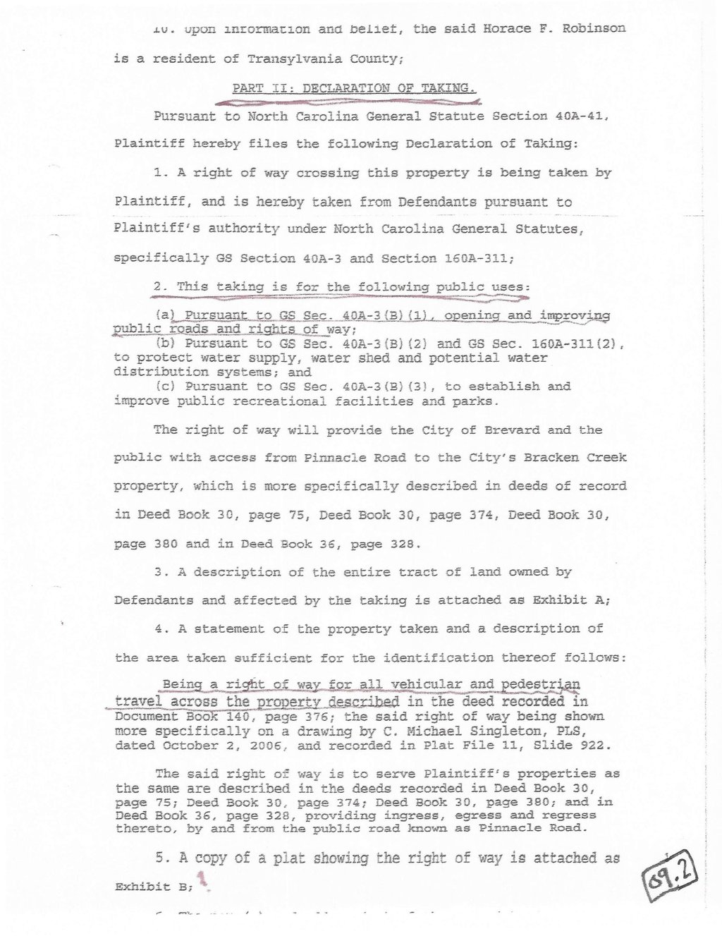
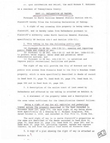
City Council Meeting Minutes (2006) -- from November 06, 2006, Meeting, stated the public purposes for this condemnation is as follows; Pursuant to GS 40A-3(b)(1), "Opening and improving public roads and right of way;" and, the Declaration of Taking (2008), from "Complaint, Declaration of Taking & Notice of Deposit" states "Taking" is for public purposes: "Opening & improving public roads & rights of way" & "for all vehicular & pedestrian travel"
Exhibit "A", from the Declaration of Taking -- clipped from the Singleton Survey, - In addition to deficiencies listed above... the Exhibit removes the title block, surveyors seal, Notes, City's Review & Acceptance Statement, File/Slide Stamp, & the Surveyor's note stating his inability to positively locate this portion of the road?? Lastly, a "Note" is added stating "THIS DRAWING IS NOT TO SCALE THIS DRAWING IS NOT A CERTIFIED SURVEY AND HAS NOT BEEN REVIEWED BY A LOCAL GOVERNMENT AGENCY FOR COMPLIANCE WITH ANY APPLICABLE LAND DEVELOPMENT REGULATIONS. GS 47-30 (n).
Affidavit of Service, for Parcel 1, Published in Transylvania Times – “stating the "Taking" is for the following public purposes: "... "being a right of way for all vehicular and pedestrian travel"
2008 Hatler Survey (partial) -- (prepared for the City of Brevard) showing the ROW & actual location of the existing Mackey Ridge Road roadbed which portions are not within the ROW???
Property Owners became aware that the lower 180' of the Trail had blocked access to the properties and met with the City to resolve (2023), appeared before the City Council (2024-2025) and to date the City has made no effort to resolve. Two of the Properties were recently denied driveway permits to access a ROW that was created "for all pedestrian & vehicular travel.”
2025 Survey -- (prepared for Roy Robinson & others) shows the actual location of Mackey Ridge Road roadbed, the overly wide ROW that is randomly shifted to the south and NOT aligned with existing roadbed! A local surveyor familiar with the area has called this "very odd!" The Survey also shows the Garrett & BMC property located on the north side of the roadbed as per the legals that leaves the prescriptive easement for the road intact as it has been since the early 1900's.
2025 Property Sketch -- Showing the location of elements that are blocking the historic road which includes, disabled parking area, 4 rows of large boulders set across the roadbed, large trees & bushes placed in the roadbed, picnic tables and trail signs placed in the roadbed, and the beginning 150' of 2011 Bracken Trail crisscrossing the ROW.
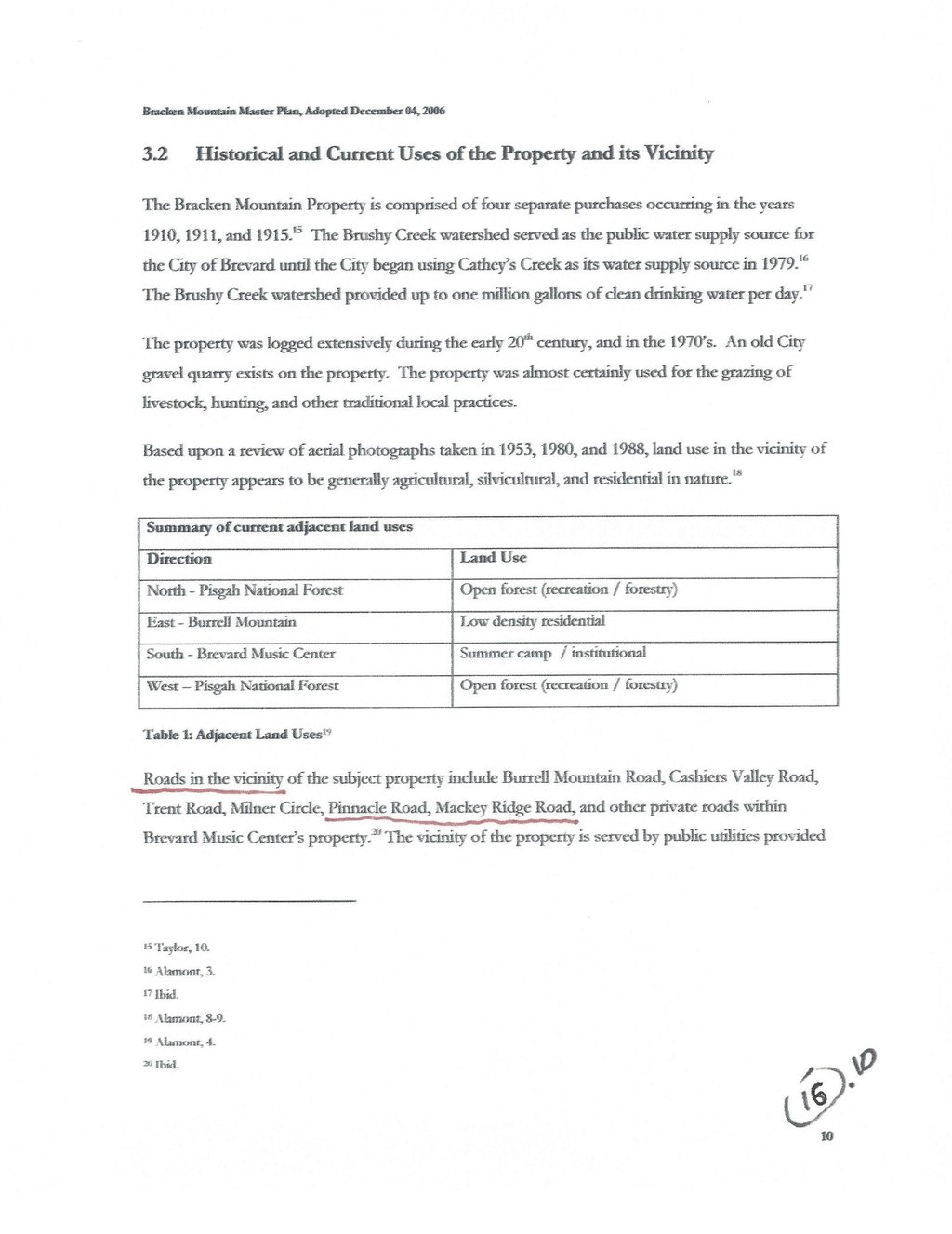
Bracken Preserve Master Plan, page 8 & 10 -- regarding access, owners of neighboring properties, and Mackey Ridge Road.
An Easy Solution would be... create a new ROW aligned with the existing Roadbed and 25' wide. A ROW that is as wide as the Pinnacle Road ROW then constructing a Road for hikers/bikers & property Owners alike. A Road constructed in and on the existing Mackey Ridge Road roadbed to be used for "for all vehicular & pedestrian travel" ...as promised by the City.
A Better Solution might be a New offset easement allowing a new alternate single track. This option could easily start in the parking lot & route around and to the north of the Garrett and BMC property and re-connect with the existing trail.
Click headings to jump to each section
A "Not So" Short Story
Family Tree of Jake & Sarah Mackey, Isaac & Ella Mackey Baley, and George & Sarah Mackey
2006 Singleton Survey, (prepared for the City of Brevard) (File 11 Slide 922)
Affidavit of Service, for Parcel 1, Published in Transylvania Times
An Easy Solution would be... create a new ROW aligned with the existing Roadbed and 25' wide
A Better Solution might be a New offset easement allowing a new alternate single track
Tap headings to jump to each section
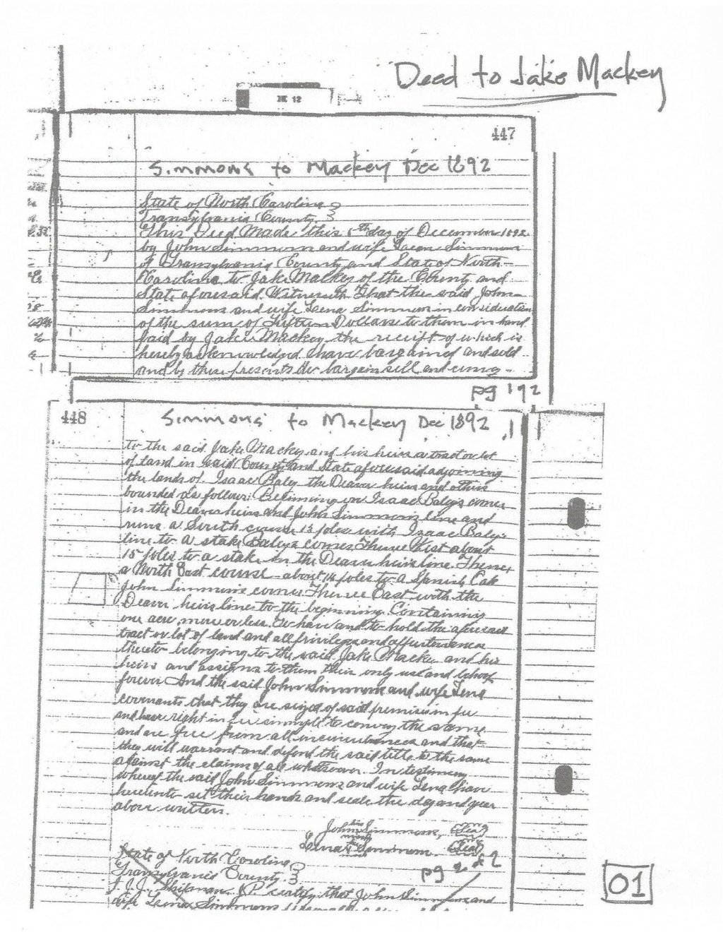
1892 Deed -- Simmons to Jake Mackey deed was recorded on 12/6/1892. Also, Issac Baley purchased the adjacent parcel on the same day. Both Mackey & Bailey may have lived on the land for years prior to purchasing.
1
1
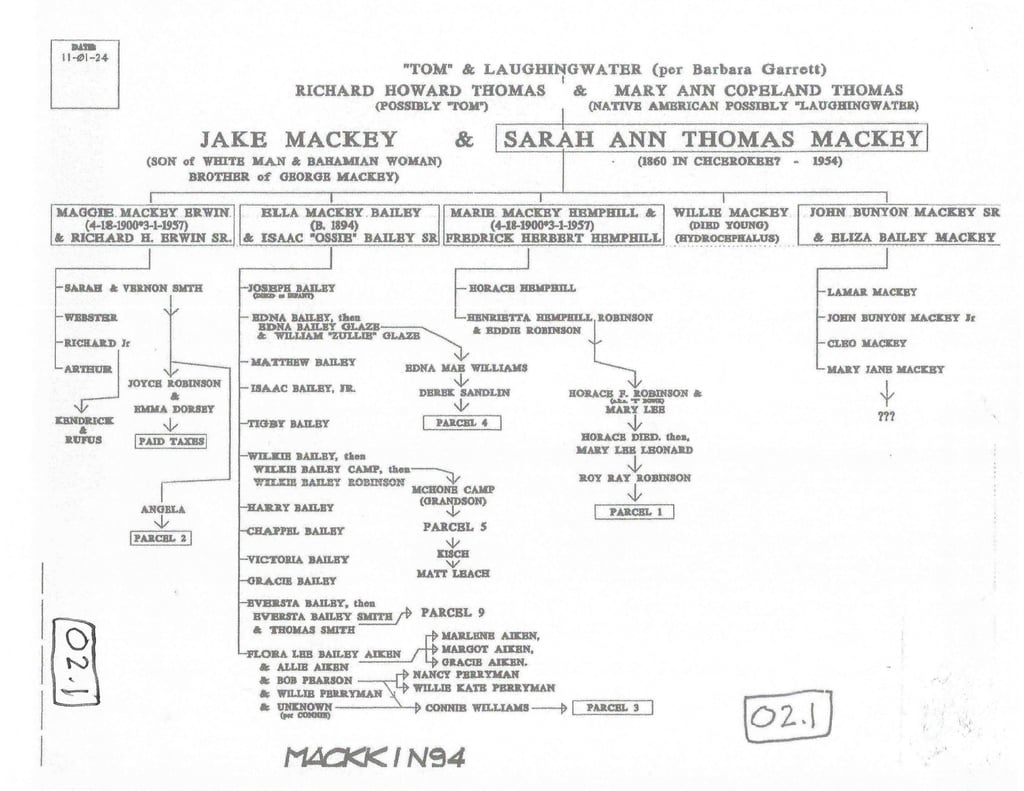
Family Tree of Jake & Sarah Mackey, Isaac & Ella Mackey Baley, and George & Sarah Mackey -- from "The Marriage List" & "Person Report of Richard Howard Thomas & Mary Ann Copeland provided by A. Towler, B. Garrett & E. Dorsey.”

2
2
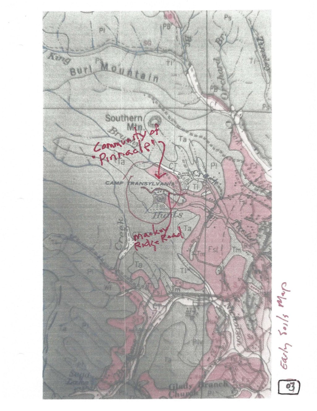
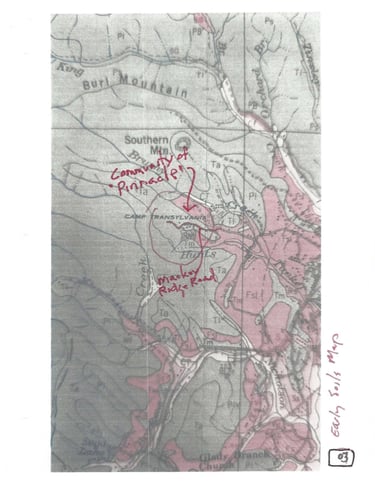
1906 Soils Map -- shows Mackey Road extending west from Probart Street leading up to the community of “Pinnacle" at the time comprised of a cluster of (5 or so) structures located between Camp Transylvania & Hunts Branch.
3
3
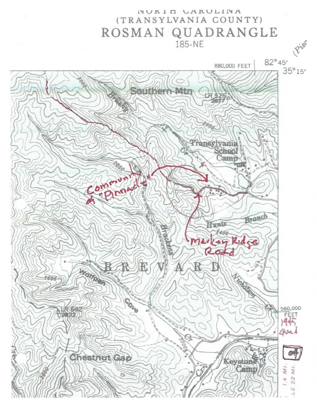
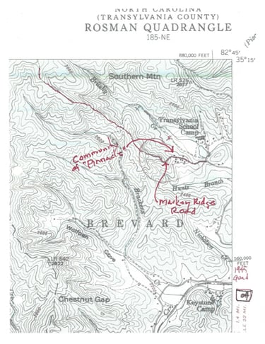
1945 USGS Quad Map (Rosman) -- shows Mackey Ridge Road & trail extending through "Pinnacle" & west well up into the mountains showing at least (9) structures on both sides of the road between Transylvania School Camp & Hunts Branch.
4
4
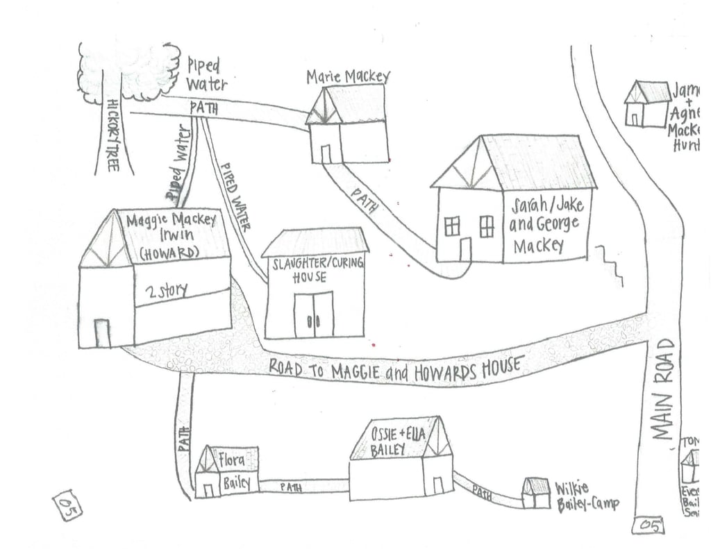
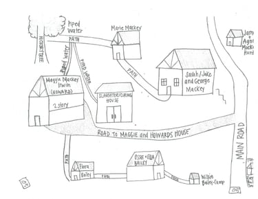
Emma Dorseys's Map of "Pinnacle" -- This "Map" was hand drawn by Emma's granddaughter in 2024 from Emma's memory. Emma was born in Brevard and lived in “Pinnacle” from the early 1940's until 1954. Emma's "Map" shows (8) houses & a Slaughterhouse, various drives, paths & the Main Road (aka Mackey Ridge Road) (now Pinnacle Road).
5
5

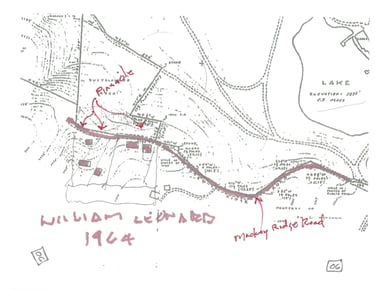
1964 William Leonard Survey (partial) -- clearly showing Mackey Ridge Road & at least (5) remaining structures in 1964.
6
6
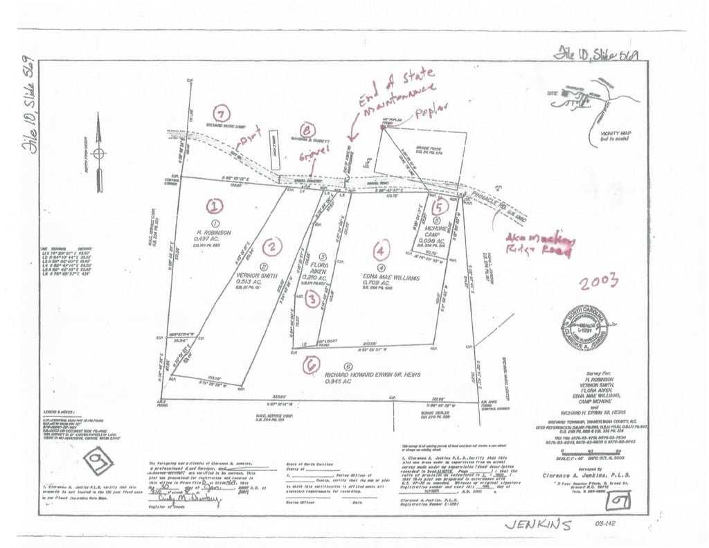
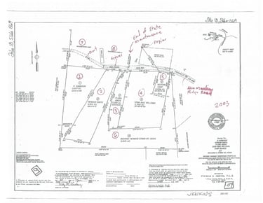
2003 Jenkins Survey -- This landmark survey is the first depiction of Jake & Isaac's land with sub-parcels all on one map. Parcel 1-5 were passed on to the Robinsons, the Smiths, Flora Bailey Aiken, Edna Mae Williams, McCone Camp and Parcel 6 to the Heirs of Jake & Isaac. Also, the BMC, Garrett & Payne parcels are indicated on the north side of the Road.
7
7
2006 Singleton Survey, (prepared for the City of Brevard) (File 11 Slide 922) -- Is titled "50' Easement for the City of Brevard" & contains incorrect information as follows.
The note "unable to positively locate end of the road” is not supported by subsequent surveys.
The BMC & Garrett Parcels appear to be shifted to the south +/-20', (effectively erasing the prescriptive ROW in which Mackey Road exists), and
The end of DOT Maintenance is shifted to the east 50-60'.
8
8
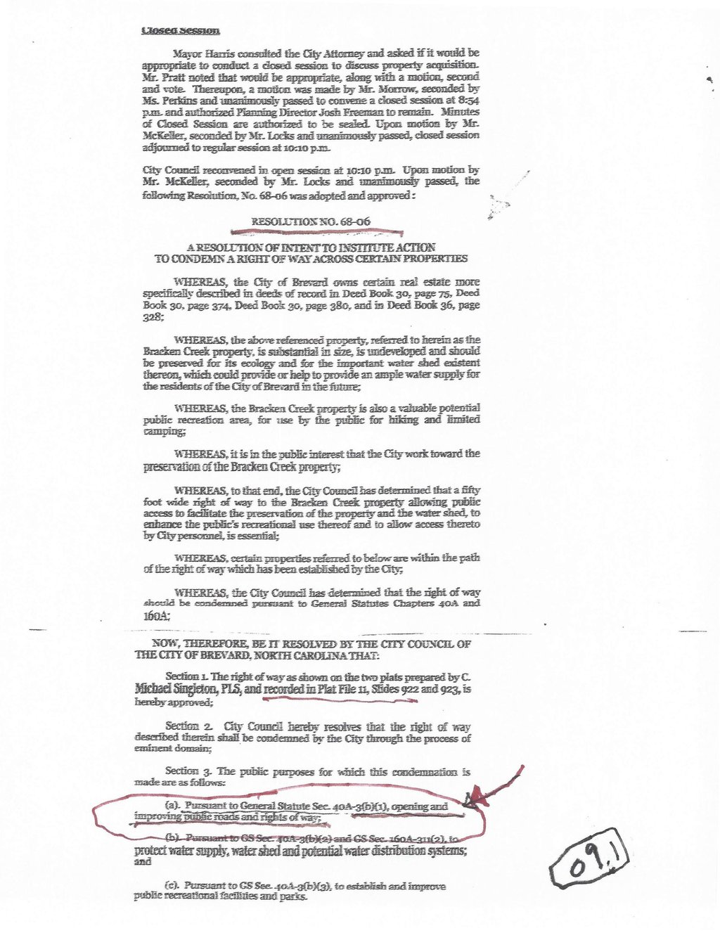
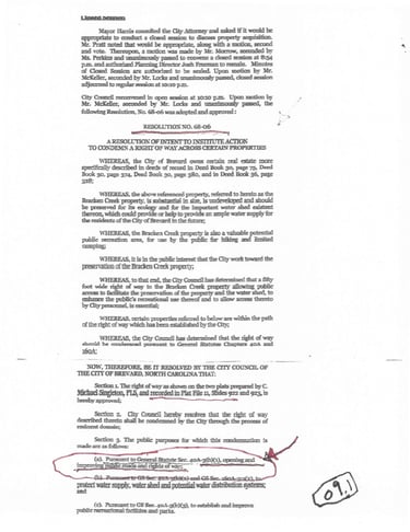
City Council Meeting Minutes (2006) -- from November 06, 2006, Meeting, stated the public purposes for this condemnation is as follows; Pursuant to GS 40A-3(b)(1), "Opening and improving public roads and right of way;" and, the Declaration of Taking (2008), from "Complaint, Declaration of Taking & Notice of Deposit" states "Taking" is for public purposes: "Opening & improving public roads & rights of way" & "for all vehicular & pedestrian travel"
9
9
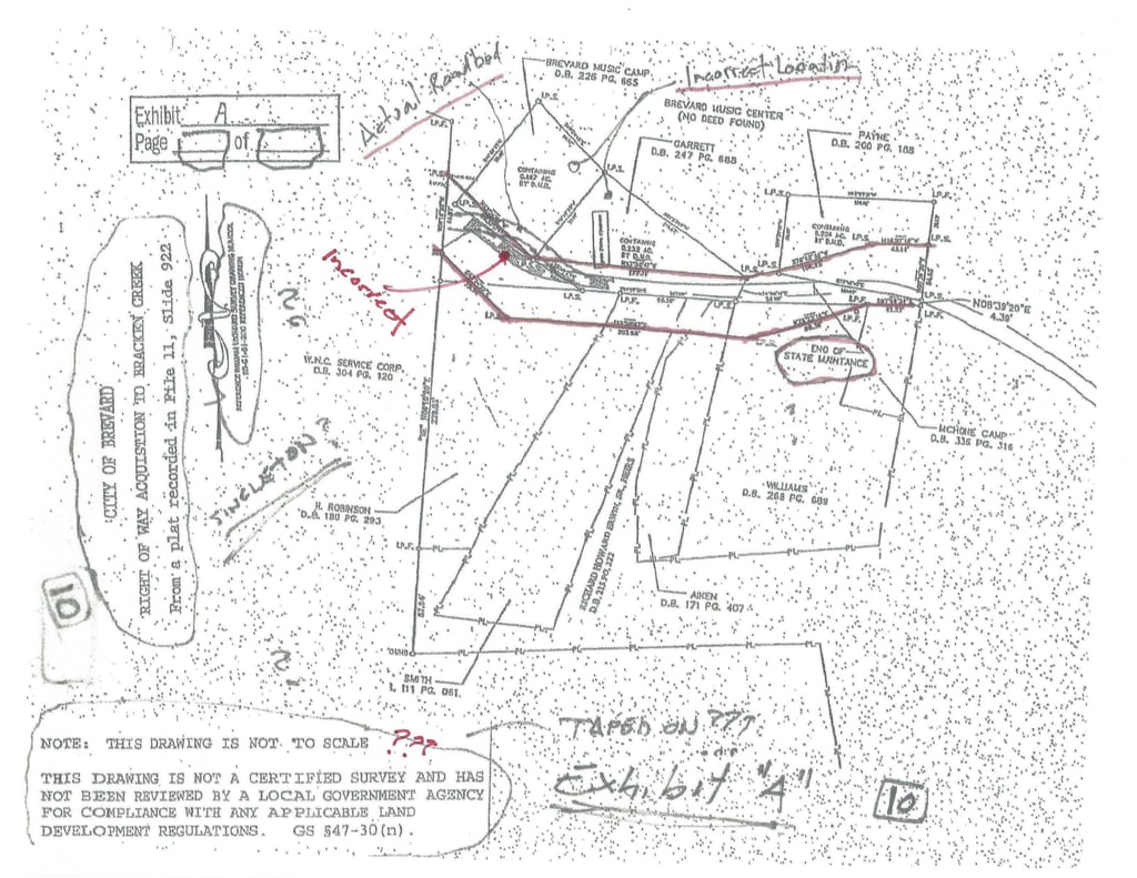
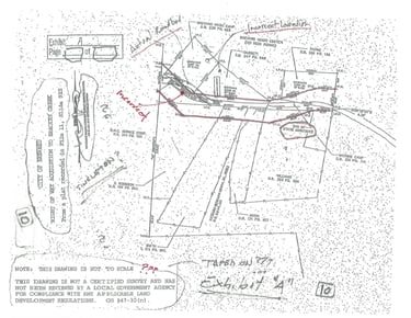
Exhibit "A", from the Declaration of Taking -- clipped from the Singleton Survey, - In addition to deficiencies listed above... the Exhibit removes the title block, surveyors seal, Notes, City's Review & Acceptance Statement, File/Slide Stamp, & the Surveyor's note stating his inability to positively locate this portion of the road?? Lastly, a "Note" is added stating "THIS DRAWING IS NOT TO SCALE THIS DRAWING IS NOT A CERTIFIED SURVEY AND HAS NOT BEEN REVIEWED BY A LOCAL GOVERNMENT AGENCY FOR COMPLIANCE WITH ANY APPLICABLE LAND DEVELOPMENT REGULATIONS. GS 47-30 (n).
10
10
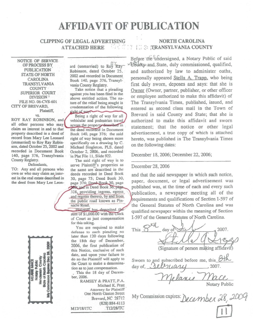
Affidavit of Service, for Parcel 1, Published in Transylvania Times – “stating the "Taking" is for the following public purposes: "... "being a right of way for all vehicular and pedestrian travel"
11
11
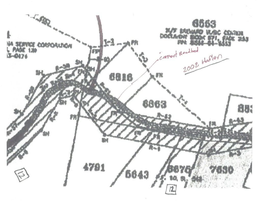
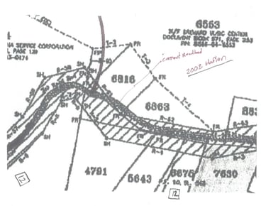
2008 Hatler Survey (partial) -- (prepared for the City of Brevard) showing the ROW & actual location of the existing Mackey Ridge Road roadbed which portions are not within the ROW???
12
12
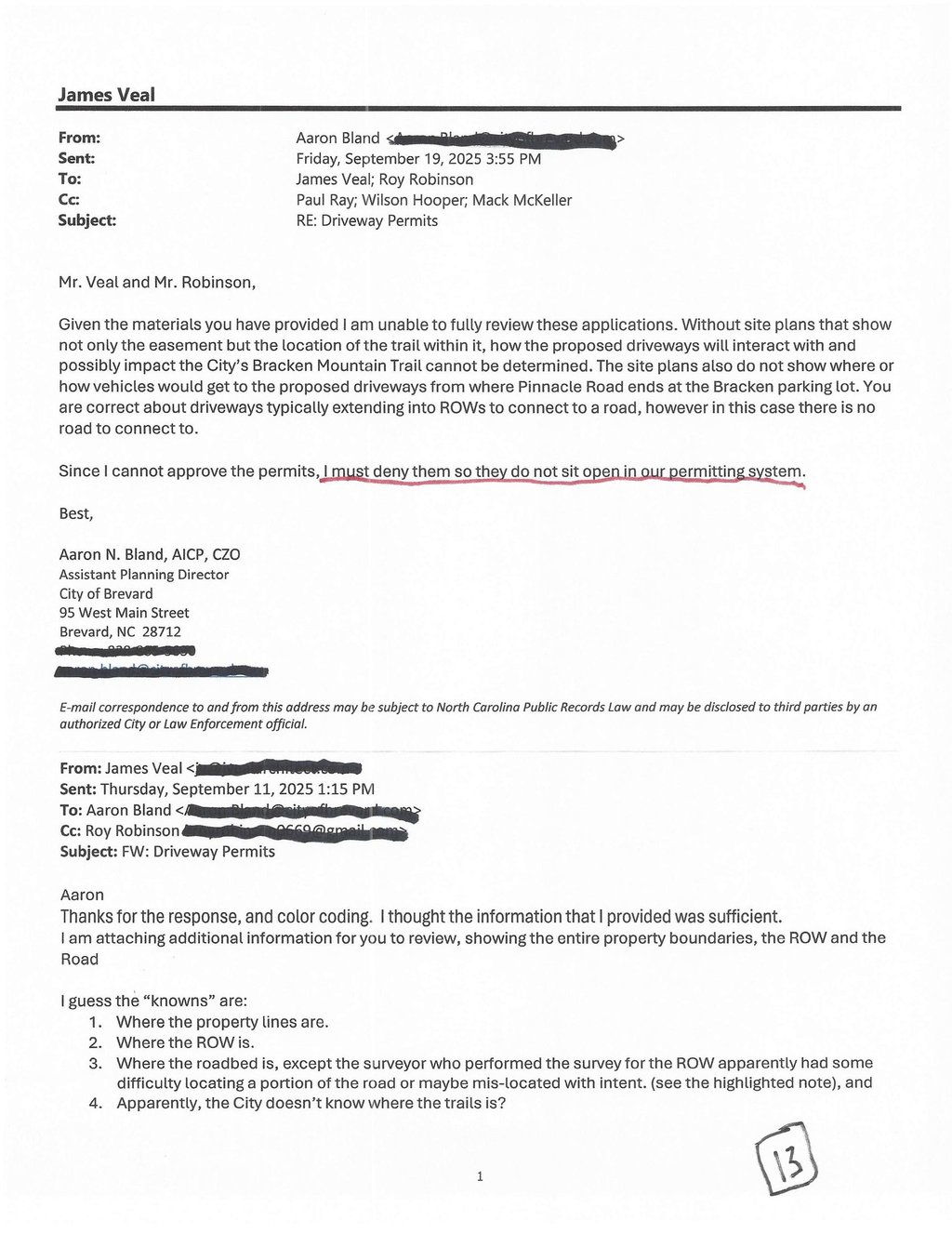
Property Owners became aware that the lower 180' of the Trail had blocked access to the properties and met with the City to resolve (2023), appeared before the City Council (2024-2025) and to date the City has made no effort to resolve. Two of the Properties were recently denied driveway permits to access a ROW that was created "for all pedestrian & vehicular travel.”
13
13
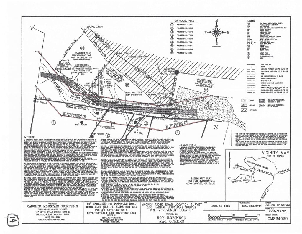
2025 Survey -- (prepared for Roy Robinson & others) shows the actual location of Mackey Ridge Road roadbed, the overly wide ROW that is randomly shifted to the south and NOT aligned with existing roadbed! A local surveyor familiar with the area has called this "very odd!" The Survey also shows the Garrett & BMC property located on the north side of the roadbed as per the legals that leaves the prescriptive easement for the road intact as it has been since the early 1900's.
14
14
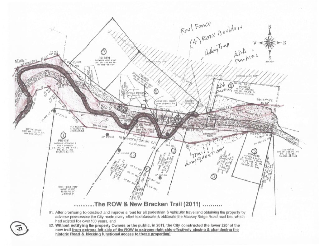
2025 Property Sketch -- Showing the location of elements that are blocking the historic road which includes, disabled parking area, 4 rows of large boulders set across the roadbed, large trees & bushes placed in the roadbed, picnic tables and trail signs placed in the roadbed, and the beginning 150' of 2011 Bracken Trail crisscrossing the ROW.
15
15
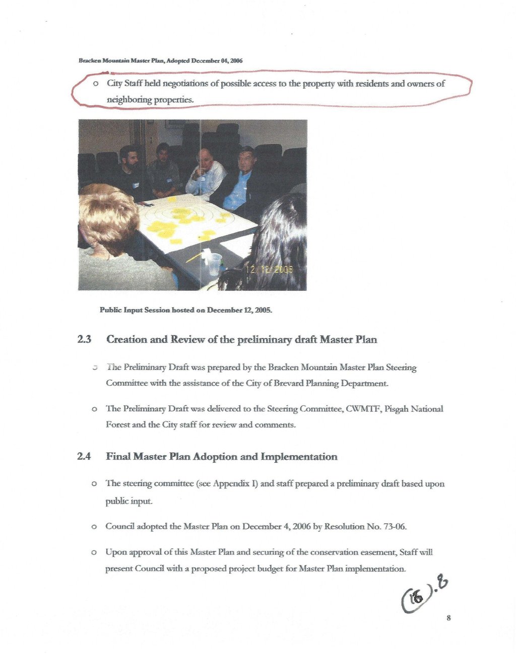

Bracken Preserve Master Plan, page 8 & 10 -- regarding access, owners of neighboring properties, and Mackey Ridge Road.
16
16
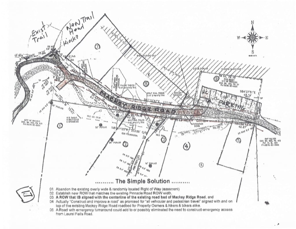
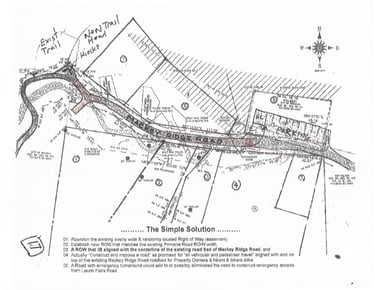
An Easy Solution would be... create a new ROW aligned with the existing Roadbed and 25' wide. A ROW that is as wide as the Pinnacle Road ROW then constructing a Road for hikers/bikers & property Owners alike. A Road constructed in and on the existing Mackey Ridge Road roadbed to be used for "for all vehicular & pedestrian travel" ...as promised by the City.
17
17


A Better Solution might be a New offset easement allowing a new alternate single track. This option could easily start in the parking lot & route around and to the north of the Garrett and BMC property and re-connect with the existing trail.